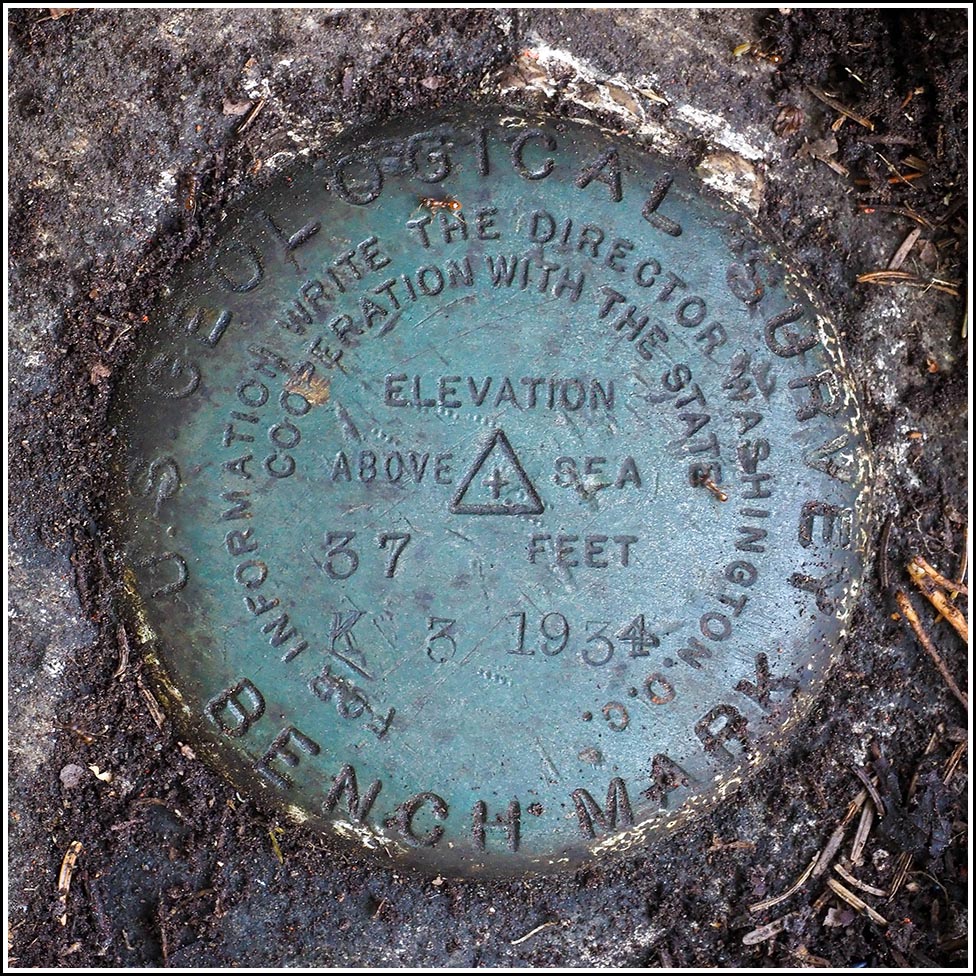
K 3
Spatial/elevation data
| Coordinates | N 44.420206° W 68.362716° |
| Elevation | 36.34 ft. |
| Location | Maine
Hancock County Salsbury Cove Quad |
Mark description
| Type | Bench Mark Disk |
| Setting | Rock Outcrop |
| Monumented | 1934 by USGS |
| Description (NGS) | NGS Datasheet |
Narrative and photographs
Although K 3 was so close to the MaineDOT mark, I doubt we would have found it without the excellent references from the witness post and the trees that are still basically as described (that’s rare, in our experience, especially after 40 years). The area was so heavily overgrown with tough spruce and blueberry and laurel and I don’t even know what else, and no outcrops were visible other than the one we’d found earlier that held the MaineDOT mark. Fortunately the reference distances were short (6 feet from the witness post and 5 feet from the twin spruce trees) so we had a pretty good idea where it must be, but it was completely buried without a hint that anything was even there (other than some very old flagging tape we found lying nearby on the ground, and of course the witness post).
I just happened to notice a small area between a triangle of roots that appeared unusually flat, and I wondered if there might be rock underneath. I scraped away a thick layer of soil and roots and found a nice outcrop! But no disk just yet. I scraped back toward myself, clearing off this little space bit by bit, and eventually uncovered a peek of the disk! We were thrilled! Just a bit more work (or maybe a lot more) and we had the whole disk cleared out and cleaned off. We sure worked for that one, and I doubt we ever would have found it without such solid references. Rich placed flagging tape around the area that should help the next person who wants to use the mark.


