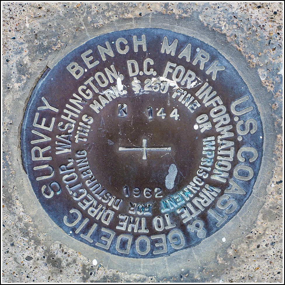
K 144
Spatial/elevation data
| Coordinates | N 44.439728° W 68.370058° |
| Elevation | 63.07 ft. |
| Location | Maine
Hancock County Salsbury Cove Quad |
Mark description
| Type | Bench Mark Disk |
| Setting | Building Foundation |
| Monumented | 1962 by NGS |
| Description (NGS) | NGS Datasheet |
Narrative and photographs
This is another mark that, like IRESON, I can hardly believe it took us this long to get to. Actually, somehow we hadn’t even noticed it until this year when we were preparing possible marks to search for on our trip. It’s clearly visible on the Street View, and as a bonus, the NGS datasheet lacks both GPS coordinates and photographs, so we were excited to be able to provide them.
We found easy parking in the empty lot of the grange hall and walked right up to the mark. As expected, it was in excellent condition, although there are some paint drips across its surface from a sloppy paint job done on the siding above the mark. Still, the stamping is clearly legible. The smell of wood smoke (for steaming the lobsters?) coming from Lunt’s Gateway Lobster Pound directly across the highway was intoxicating. It smelled like summer and fall at once.


