NJDPF(1)
NJDPF(1)
Spatial/elevation data
| Coordinates | N 41.142833° W 74.312916° |
| Elevation | Unknown |
| Location | New Jersey
Passaic County Greenwood Lake Quad |
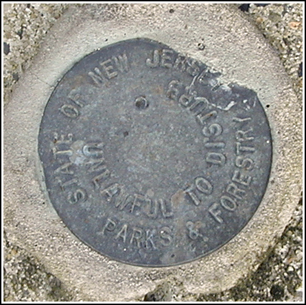
Mark description
| Type | Unspecified Disk |
| Setting | Square Concrete Monument |
| Monumented | Unknown by New Jersey Division of Parks and Forestry |
| Description (New Jersey Division of Parks and Forestry) | Unavailable. |
Narrative and photographs
Though I knew ahead of time that our day wouldn’t feel complete without finding a survey mark or two, I hadn’t planned on seriously searching for any in the area. There just weren’t any NGS marks that looked interesting enough or were close enough to our chosen route. I was pleasantly surprised, then, when on our way to the Long Pond furnaces, I happened to stop along the trail to point out some old stone walls I saw in the distance, and I spotted a concrete monument and disk right at my feet! We later discovered that the old stone walls had been the south and north walls of the so-called “Old Long House,” which probably served as a dormitory for iron workers. These walls are all that now remains of this building.
The mark is approximately 0.2 miles northeast along the Sterling Ridge trail from its trailhead along Route 511, and east of the southern wall of the Old Long House. The mark and monument appear to be in good condition, but there is no identifying information on the disk other than the agency name: the New Jersey Division of Parks & Forestry. We found another similar disk only a few hundred feet northeast along the trail, just east of the remains of the northern wall.
This disk has no apparent designation and I have not been able to find any information or datasheet for it. I wonder if it may have been placed in anticipation of restoration of the old structures in the area.


