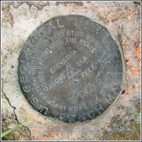
TT 40 R (NB2147)
TT 40 R
Spatial/elevation data
| Coordinates | N 42.432922° W 76.862933° |
| Elevation | 740.57 ft. |
| Location | New York
Schuyler County Burdett Quad |
Mark description
| Type | Bench Mark Disk |
| Setting | Rock Outcrop |
| Monumented | 1942 by USGS |
| Description (NGS) | NGS Datasheet |
NGS recovery information
Descriptive text
Recovered in good condition.Narrative and photographs
Our main activities for today were to visit Seneca Lake with my parents and sample some of the local wines, but I couldn’t resist hunting for a few survey marks while in a new area. (Note: we found both marks before we started sipping wine!)
TT 40 R, a USGS bench mark disk that is also in the NGS database, is located just north of the town of Burdett, on the eastern shore of Seneca Lake. It’s set on an outcrop at the point where Tug Hollow Road and State Route 414 meet at a triangle. The disk has a “witness sign” of sorts, actually a small sign on a short post for the The Old H&E Bar (must be somewhere nearby). The outcrop is overgrown but the disk is in good condition and still pretty easy to spot. There are signs of paint surrounding the mark, although it’s not fresh.


