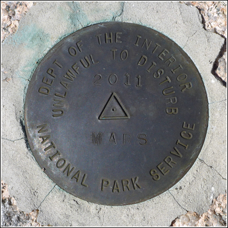
MARS
MARS
Spatial/elevation data
| Coordinates | N 44.379512° W 68.263102° |
| Elevation | 704.570 ft. |
| Location | Maine
Hancock County Salsbury Cove Quad |
Mark description
| Type | Triangulation Station Disk |
| Setting | Rock Outcrop |
| Monumented | 2011 by National Park Service |
| Description (National Park Service) | The mark is a 3 1/2 inch brass disk with a 2 1/4 inch flanged stem set in a drill hole with hydraulic cement. Contact Acadia NP before visiting. To locate, drive to Eagle Lake Road. Go about 0.1 mile west from Park HQ. On the north side of the road there is an unmarked pull off and a locked gate. Park at the weather station. Hike 0.2 mile up the hill following the deer trail. Mark is near the summit in exposed bedrock. The mark is part of the NPS-URI network of backbone monuments for Acadia NP. See: Shared Solution for MARS |
Narrative and photographs
Rich and I spent part of our sixth anniversary on MARS!
Well, actually, we spent it hiking with Dad, exploring McFarland Mountain. It was perfect! Our main goal was to see how we could access the mountain (our first try this morning, via the Acadian Ridge Trail, didn’t work out so well). We then hiked through the field and straight up the ski slope, as suggested by Matt Marchon, so we could locate the old ski tow rope equipment. (Next time, we’ll try the trail to the top that meets the weather station road near its intersection with Eagle Lake Road.)
Other than the short, steep, straight shot up the old ski slope, it was an easy hike to the summit, which is marked by a large cairn. The MARS disk is nearby and it was in excellent condition, as expected. It was so cool to show Dad part of the park, and some excellent views, that few people have ever seen—and to see them for ourselves!


 is close to the summit cairn.")