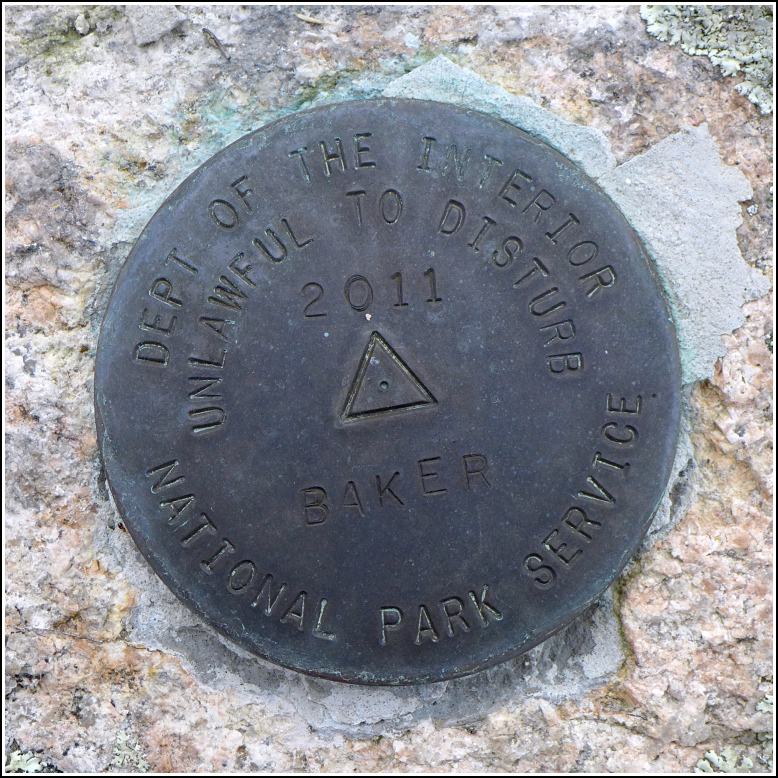
BAKER
BAKER
Recovered in Good Condition on September 14, 2017
Spatial/elevation data
| Coordinates | N 44.241989° W 68.199208° |
| Elevation | 78.559 ft. |
| Location | Maine
Hancock County Baker Island Quad |
Mark description
| Type | Triangulation Station Disk |
| Setting | Rock Outcrop |
| Monumented | 2011 by National Park Service |
| Description (National Park Service) | The mark is a 3 1/2 inch brass disk with a 2 1/4 inch flanged stem set in a drill hole in bedrock with hydraulic cement. It is best accessed by utilizing the National Park Service’s Ranger-led interpretive boat cruise to Baker Island. Once on the island, follow the foot path up toward the light house. It is about 250 ft north of the light house and 150 ft east of the foot path. The mark is part of the NPS-URI network of backbone monuments for Acadia National Park. See: Shared Solution for BAKER |
Narrative and photographs
Although Rich and I were here in 2014, we weren’t aware of this survey mark at the time. We returned this year with Dad, who had a great time on Baker Island and wasn’t even too bothered by the need to transfer to the island by way of a small skiff—something I had been a little concerned about due to his history of seasickness.
After enjoying the talk by the ranger and hiking to the south beach where we had our lunch, the three of us returned a bit early to the area near the lighthouse so we could search for the mark. It was an easy find, on the ledge where we expected to find it. Nearby is a long line of rocks, possibly from an old wall or part of a foundation. The disk is in excellent condition.


