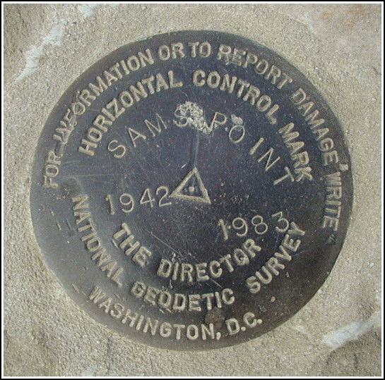
SAMS POINT RESET (LY2900)
SAMS POINT RESET
Spatial/elevation data
| Coordinates | N 41.669852° W 74.357398° |
| Elevation | 2231 ft. |
| Location | New York
Ulster County Napanoch Quad |
Mark description
| Type | Horizontal Control Disk |
| Setting | Rock Outcrop |
| Monumented | 1983 by NGS |
| Description (NGS) | NGS Datasheet |
Narrative and photographs
We hiked directly to Sam’s Point after parking and attempting to access the Conservation Center, which was locked up tight. The views along this eastern section of the Loop Road are stunning, if hiking the road itself is rather tedious. A quick check on the coordinates of the Sam’s Point tri-station upon reaching one of the expansive rock outcrops to the right of the trail told us that we were within three hundred feet of the mark. Seeing no direct route to the station via the road, we bushwhacked up to the highest point (which we presumed, correctly, to be Sam’s Point) through pine and heavy scrub … emerging directly on top of the mark, at the platform with a side road leading directly to it. I suppose it’s no fun taking the easy route.
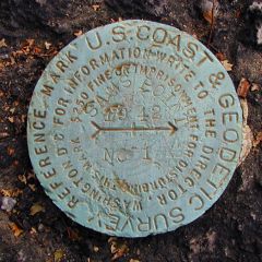
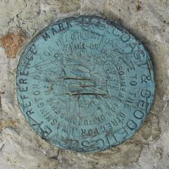
The station is in excellent condition, particularly given its exposed location. Both reference marks were found in fair condition at the given distance and direction from the station mark. As noted in the description, RM 2 has suffered some damage from a sharp instrument. At the time we were unaware of the existence of an azimuth mark for this station, so we will have to wait until our next visit to search for and report on it. An updated to-reach will be written and submitted to NGS with our official recovery report.


| Designation | Status | Condition | Image |
|---|---|---|---|
| SAMS POINT AZ MK | Note Entered | Unknown (Not Found) |

|
| SAMS POINT RM 1 | Recovered | Good |
|
| SAMS POINT RM 2 | Recovered | Good |
|