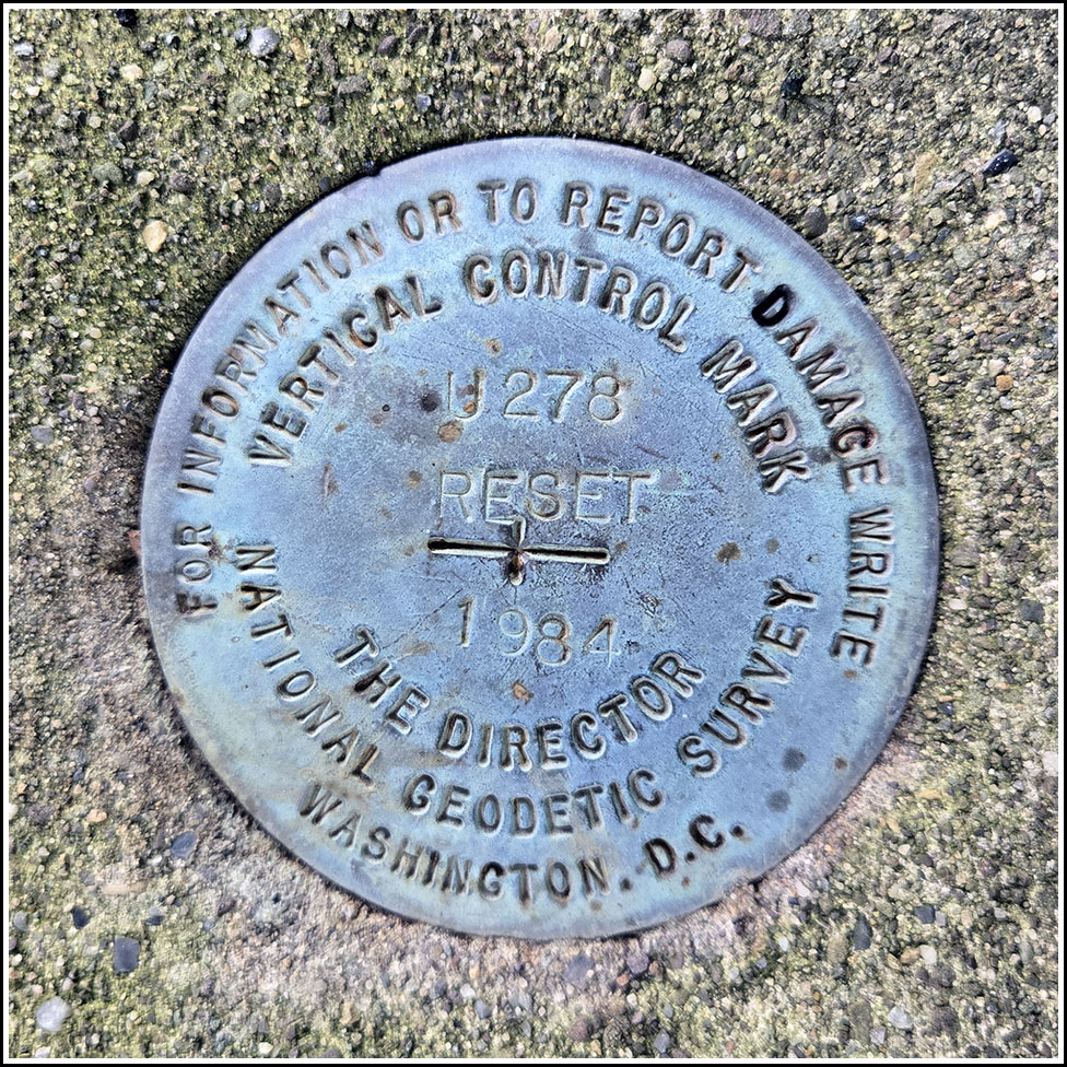
U 278 RESET
Spatial/elevation data
| Coordinates | N 41.453662° W 75.650289° |
| Elevation | 936.8 ft. |
| Location | Pennsylvania
Lackawanna County Scranton Quad |
Mark description
| Type | Vertical Control Disk |
| Setting | Parapet Wall |
| Monumented | 1984 by PennDOT |
| Description (NGS) | NGS Datasheet |
Narrative and photographs
I was in the area this morning to accompany my father to a medical appointment, and I thought it would be a good opportunity to document this mark. Rich and I are sure we’d seen this mark once before when we visited this “bridge to nowhere,” but for some reason we didn’t recover the mark at that time. I recently heard that this bridge is to be demolished soon, so I wanted to have a record of the mark before the demolition occurs.
Based on the mark’s location on the parapet wall at the very end of the bridge, it is possible that it may remain in place even after the demolition, but I didn’t want to take any chances. Once the bridge is gone, we can return to this spot and submit a recovery of the mark’s fate, whatever it is. For now, the disk and its setting are in good condition.


