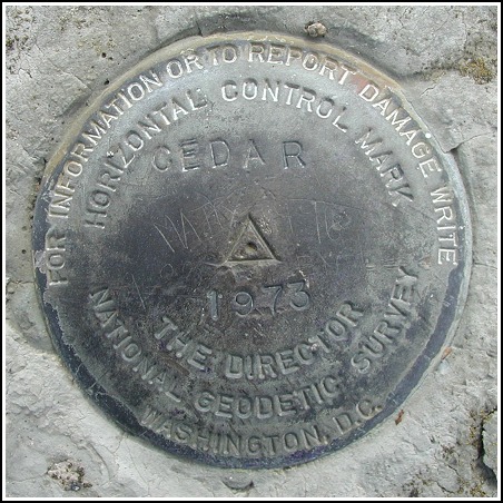
CEDAR (LY2560)
CEDAR
Spatial/elevation data
| Coordinates | N 41.103864° W 74.417616° |
| Elevation | 1344 ft. |
| Location | New Jersey
Passaic County Newfoundland Quad |
Mark description
| Type | Horizontal Control Disk |
| Setting | Rock Outcrop |
| Monumented | 1973 by NGS |
| Description (NGS) | NGS Datasheet |
Narrative and photographs
While Aaron sat at a convenient picnic table and munched on half of a cinnamon granola bar, I searched for these marks. We’d accidentally left the benchmark page printout in the car, so I didn’t have high hopes of finding anything (other than LY2561). But on our way to the tower I spotted RM 1 on a boulder and was inspired to search for the others. They were both straightforward to locate, and all markers are in good condition as noted by Rich.

(Recovered on March 27, 2003)
This triangulation station is in the immediate vicinity of the “Bearfort Fire Tower” located in the Pequannock River watershed . The historic descriptions lead to the correct locations for all three marks. At the station mark my Garmin GPSmap76 receiver indicated 9.2 feet from the NGS datasheet coordinates. The discs are in very good condition and well exposed, and the stamped designations are legible. There is no azimuth mark for this station. ~Rich in NEPA~


| Designation | Status | Condition | Image |
|---|---|---|---|
| CEDAR RM 1 | Recovered | Good |
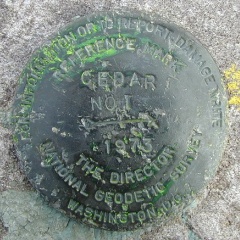
|
| CEDAR RM 2 | Recovered | Good |
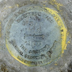
|