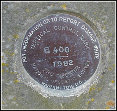
E 400 (LY2401)
E 400
Recovered in Good Condition on December 1, 2002
Update (April 3, 2015)
Spatial/elevation data
| Coordinates | N 41.9631° W 75.583317° |
| Elevation | 926.57 ft. |
| Location | Pennsylvania
Susquehanna County Susquehanna Quad |
Mark description
| Type | Vertical Control Mark |
| Setting | Bridge Pier |
| Monumented | 1982 by NGS |
| Description (NGS) | NGS Datasheet |
Narrative and photographs
This was an easy find on a very cold and windy Sunday! I parked quite a distance down the road and walked along ice-covered sidewalks to the viaduct. The benchmark is easy to spot and is in good condition. This is a special one for me because my grandmother was born in Lanesboro and lived there until 1930. I remember going to Lanesboro see her old house when I was very young, and the viaduct made an impression on me even then.

