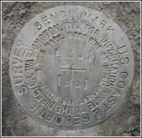
L 281 (LY1604)
L 281
Recovered in Good Condition on May 16, 2003
Spatial/elevation data
| Coordinates | N 41.336233° W 75.551433° |
| Elevation | 1752.48 ft. |
| Location | Pennsylvania
Lackawanna County Moscow Quad |
Mark description
| Type | Bench Mark Disk |
| Setting | Rock Outcrop |
| Monumented | 1961 by NGS |
| Description (NGS) | NGS Datasheet |
Narrative and photographs
This was another mark I spotted from the car while driving by. I turned around as soon as I could and parked nearby. While the surroundings have changed since the description was written, the mark is still in place and is in very good condition (the south side of the highway remains undeveloped at this location). It’s my educated guess that this ‘281’ series of benchmarks was used in the construction of the nearby Interstate highways. There’s plenty of fascinating history here, and where would we geocachers and benchmark hunters be without the Interstates?
(By the way, sometimes I think I should wear a sign saying “No, my car’s not broken down” when I hunt roadside benchmarks.)
