T 288
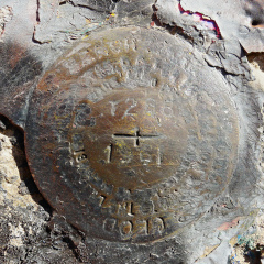
Recovered in Good Condition on November 8, 2014
Previous attempt (October
29, 2014)
Spatial/elevation data
| Coordinates | N 41.400405° W 75.650909° |
| Elevation | 828.26 ft. |
| Location | Pennsylvania
Lackawanna County Scranton Quad |
Mark description
| Type | Bench Mark Disk |
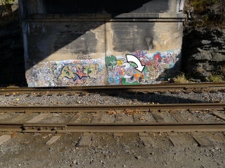
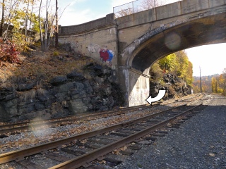
| Setting | Bridge Abutment |
| Monumented | 1961 by NGS |
| Description (NGS) | NGS Datasheet |
NGS recovery information
Descriptive text
Recovered in good condition. The disk is worn but the stamping is still legible. The Harrison Avenue bridge is being replaced, and the abutment holding the mark may be removed. This mark is in danger of being disturbed or destroyed.Narrative and photographs
Rich and I stopped by this morning after a walk at Lake Scranton. I’ve been waiting a few weeks for the parked train that had been obscuring the mark to move. It finally did! We parked near the University tennis courts to access the mark just a short walk away. The disk is in good condition and somehow has avoided being covered by the graffiti that “decorates” the rest of this abutment’s southern face.
Next year a new bridge will be built adjacent to this one, and the old bridge (possibly including the abutments as well) will be torn down. We will be able to update the database again if that occurs.


