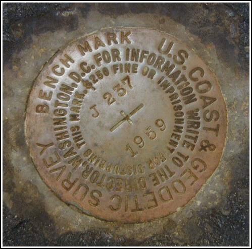
J 237 (LY1149)
J 237
Recovered in Good Condition on May 1, 2004
Spatial/elevation data
| Coordinates | N 41.36135° W 75.07475° |
| Elevation | 1318.19 ft. |
| Location | Pennsylvania
Pike County Pecks Pond Quad |
Mark description
| Type | Bench Mark Disk |
| Setting | Boulder |
| Monumented | 1959 by NGS |
| Description (NGS) | NGS Datasheet |
NGS recovery information
Descriptive text
Recovered in good condition. Handheld GPS WAAS-corrected coordinates for the station are 41 21 40.86(N) 075 04 29.10(W).Narrative and photographs
We were happy to have an easy, straightforward recovery after our difficult search for LY1153 (E 237). This mark was found just as described. It is in good condition with legible stamping.


N 41° 21.681’ W 075° 04.485’
Recovered in good condition.
This second order vertical control station was found as described. The 1959 to-reach directions are still viable. At the station a Garmin GPSmap76 receiver with remote active antenna was used to record WAAS-corrected coordinates which were 15.2 feet from the scaled coordinates listed in the NGS datasheet. The mark is well exposed, in good condition, and the stamped designation is legible.
~Rich in NEPA~


