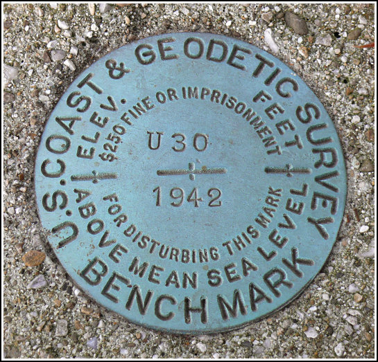
U 30 (LY0755)
U 30
Spatial/elevation data
| Coordinates | N 41.094283° W 74.95878° |
| Elevation | 682.48 ft. |
| Location | New Jersey
Sussex County Flatbrookville Quad |
Mark description
| Type | Bench Mark Disk |
| Setting | Concrete Post |
| Monumented | 1942 by NGS |
| Description (NGS) | NGS Datasheet |
NGS recovery information
Descriptive text
The station is located at the intersection of Old Mine Road (Route 615) and Flatbrookville-Stillwater Road. The large 2-story farmhouse still exists and is now the Delaware View House General Store. The standard reference post no longer exists. The station is set in a concrete post as described, and is approximately 41 feet 9 inches at 307 degrees magnetic from utility pole NJ1599SW. Handheld GPS WAAS-corrected coordinates for the station are 41 05 39.4(N) 074 57 31.6(W).Narrative and photographs
Finally, some luck for our last mark of the day! After unsuccessful searches for three other marks in the “30″ series along the Flatbrookville-Stillwater Road (LY0756, LY0757, LY0758) we were losing hope, but this mark was still in place and was easy to find. We pulled into the driveway of the old farm house (now the Delaware View House General Store) and could see the mark’s concrete monument immediately, as it projects several inches. The disk is in excellent condition. Orange tape encircles the monument, so the mark may have been in use quite recently.
If the day had been warmer and less windy, we would have stayed longer to explore the grounds and enjoy the beautiful view from the old farmhouse. As it was, we hurried back to the car after taking our photos and measurements. This would be a lovely picnic spot … in May!


