NEVERSINK
Spatial/elevation data
| Coordinates | N 41.36099° W 74.68514° |
| Elevation | 431.05 ft. |
| Location | New York
Orange County Port Jervis South Quad |
Mark description
| Type | Bench Mark Disk |
| Setting | Bridge Abutment |
| Monumented | 1933 by NGS |
| Description (NGS) | NGS Datasheet |
NGS recovery information
Descriptive text
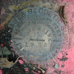
Recovered in good condition as described. Handheld GPS coordinates for the bench mark are 41 21 39.6(N) 074 41 06.5(W).Narrative and photographs
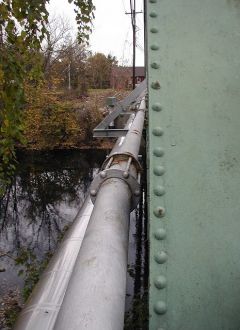
This benchmark was an easy find; not only was there fluorescent pink paint surrounding the marker, but there was also pink tape just above the marker on the guard rail and on the bridge. The heavy volume of traffic made it challenging enough just getting to the location. The coordinates seem to be slightly off, but the description is adequate. The marker is in good condition; I wish I could’ve cleaned it off a little better for the photo, but I felt that the traffic was a little too close and I didn’t want to spend too much time in this spot. It’s neat to think that this marker may have been used relatively recently.


