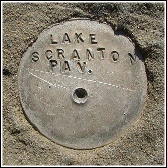
LAKE SCRANTON PAV
LAKE SCRANTON PAV
Recovered in Good Condition on April 29, 2003
Spatial/elevation data
| Coordinates | N 41.397616° W 75.625733° |
| Elevation | Unknown |
| Location | Pennsylvania
Lackawanna County Scranton Quad |
Mark description
| Type | Unspecified Disk |
| Setting | Concrete Sidewalk |
| Monumented | Unknown by Unknown Agency |
Narrative and photographs
Hard to believe Rich and I have passed this so many times without seeing it! I suppose it’s because we haven’t gone up to the pavilion since we started looking for benchmarks. This morning I decided to take a quick break from my jog around the lake and check out the view from the base of the old pavilion. I was surprised to see this survey disk!
At about 2 inches in diameter, this is a smaller disk than the typical USGS or NGS benchmarks. I have no idea what organization set this mark or where we could find data for it.


