H 363 (KV2899)
H 363
Spatial/elevation data
| Coordinates | N 40.777066° W 75.26795° |
| Elevation | 533.66 ft. |
| Location | Pennsylvania
Northampton County Wind Gap Quad |
Mark description
| Type | Vertical Control Mark |
| Setting | Steel Rod |
| Monumented | 1978 by NGS |
| Description (NGS) | NGS Datasheet |
Narrative and photographs
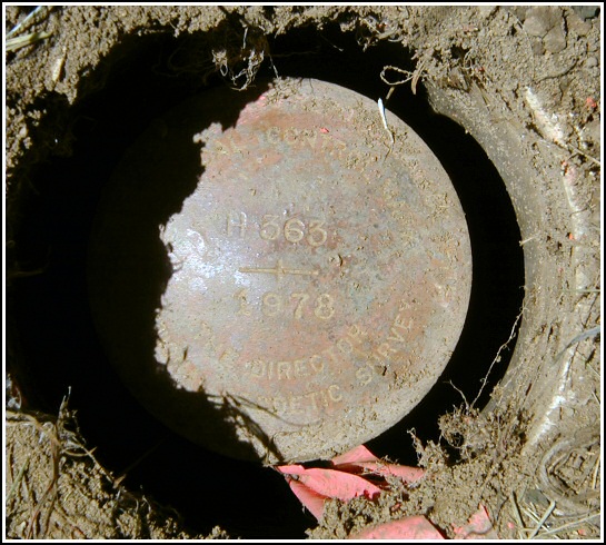
Out on our bikes today, Rich and I rode to this mark from the nearby Plainfield Township Rails-Trail. The mark was an easy find because the pole (MET ED 8722-53559/PN-52/618-16) and witness sign are still in place, and the description is mostly accurate. The mark is set just below the level of the ground in a pipe, which was then covered over by a small flat rock. The mark is apparently in current use, as the rock and mark both show signs of pink paint and some pink flagging tape was found near the mark. The mark is in good condition with legible stamping.


N 41° 46.623’ W 075° 16.077’
Recovered in good condition.
This first order vertical control station is located near the intersection of Rt. 191 and Belfast Road. It is 2 feet northwest of a standard witness post and sign, and 2 feet southeast of powerpole number MET ED 8722-53559, PN-52, 618-16. The mark is just below the level of the ground and encased in a section of pipe which was loosely covered with a flat rock. The historical description leads reliably to the station, except for the powerpole ID numbers. At the station a Garmin GPSmap76 receiver with remote active antenna was used to record WAAS-corrected coordinates which were 142.5 feet from the scaled coordinates listed in the NGS datasheet. The mark is in good condition and the stamped designation is legible.
~Rich in NEPA~


