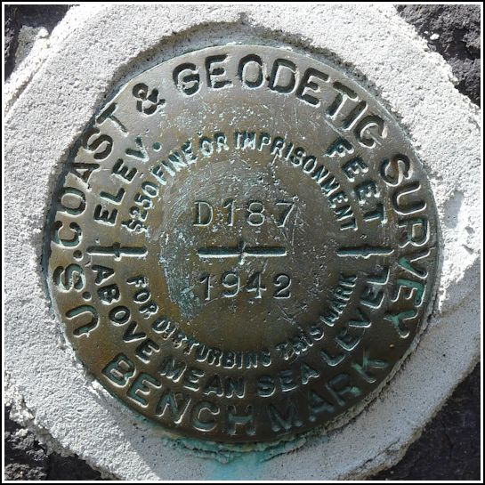
D 187 (KV2076)
D 187
Recovered in Good Condition on April 21, 2013
Spatial/elevation data
| Coordinates | N 40.453333° W 75.22345° |
| Elevation | 500.75 ft. |
| Location | Pennsylvania
Bucks County Bedminster Quad |
Mark description
| Type | Bench Mark Disk |
| Setting | Stone Building |
| Monumented | 1942 by NGS |
| Description (NGS) | NGS Datasheet |
NGS recovery information
Descriptive text
Recovered in good condition. Handheld GPS coordinates for the mark are 40 27 12.0(N) 075 13 24.4(W).Narrative and photographs
This was the first of several survey marks we had in mind to search for after our hike at nearby Lake Nockamixon. The disk is in excellent condition and set exactly as described. The church is now called St. Matthew’s Evangelical Lutheran Church. My father particularly liked the picturesque setting of this mark. Rich and I were glad that we didn’t have to go digging in the bushes to find it!

