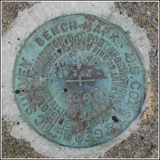
V 268
Spatial/elevation data
| Coordinates | N 40.636067° W 75.19275° |
| Elevation | 175.65 ft. |
| Location | Pennsylvania
Northampton County Easton Quad |
Mark description
| Type | Bench Mark Disk |
| Setting | Concrete Sidewalk |
| Monumented | 1960 by NGS |
| Description (NGS) | NGS Datasheet |
NGS recovery information
Descriptive text
Recovered in good condition on the south sidewalk of the bridge on Canal Road. The red brick house no longer exists. Handheld GPS coordinates for the mark are 40 38 09.8(N) 075 11 33.9(W).Narrative and photographs
This find is courtesy of the BenchMap app (thank you, Mike/TSQMadness!). Rich, Dad and I were on our way to the Mariton Wildlife Sanctuary for a morning of hiking before the Banff Mountain Film Festival in the evening. While Rich drove along Route 611 (a terrifyingly narrow but breathtaking beautiful lane alongside the Delaware River), I checked BenchMap to see what marks might be nearby. We were coming right up on V 268! It was worth a look.
Rich parked on Raubsville Rd., directly across Route 611 from Canal Road, where we expected to find the mark. Dad and I crossed the highway and walked right up to the mark on the bridge over the old Delaware Canal. The disk is in very good condition with easily legible stamping. While I took photos, Dad wandered around to check out the canal towpath and the historic buildings in the area.


