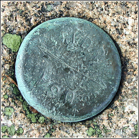
JDR/USA
JDR/USA
Spatial/elevation data
| Coordinates | N 44.354583° W 68.1932° |
| Elevation | Unknown |
| Location | Maine
Hancock County Bar Harbor Quad |
Mark description
| Type | Unspecified Disk |
| Setting | Rock Outcrop |
| Monumented | Unknown by Unknown Agency |
Narrative and photographs
What an adventure! After a long, hot, wonderful morning of sunrise-viewing, seal-watching, benchmark hunting and hiking, Rich and I decided we’d enjoy an afternoon hike up on Champlain Mountain. As the Precipice Trail was closed this early in the season (to my great disappointment), we decided to hike the Bear Brook Trail instead. The hike began in the same kinds of conditions we’d experienced all morning—sunny and humid—but halfway up, we heard something, turned, and saw a thunderstorm coming at us straight across the bay. Yikes! We had little time to do anything but cover ourselves, crouch down, and wait. It was frightening, exhilarating, and hilarious all at once. The storm passed directly over and the thunder was amazing, but we didn’t experience any nearby lightning strikes. The rain was pounding us like handfuls of stones; I could hardly believe it was simply rain and not hail. After the storm passed (and after Rich took a few wacky photos of me wrapped up in my emergency poncho), we set out again for the top of the mountain. And of course, it showered once or twice more. This time we got soaked, but didn’t mind as the air was still warm. Our main goal for this hike was to search for the NEWPORT tri-station (which Rich had already found a few years ago, but was new to me), but along the way back down we also spotted this mark, JDR/USA. This weathered boundary marker is found along the Bear Brook Trail on the north ridge of Champlain Mountain.

