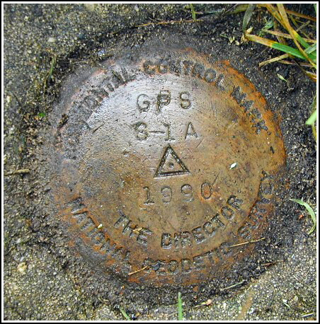
GPS S 1 A (HU2671)
GPS S 1 A
Recovered in Good Condition on September 1, 2003
Spatial/elevation data
| Coordinates | N 38.547883° W 75.1509° |
| Elevation | 17.17 ft. |
| Location | Delaware
Sussex County Frankford Quad |
Mark description
| Type | GPS Survey Monument |
| Setting | Square Concrete Monument |
| Monumented | 1990 by Delaware Dept. of Highways and Transportation |
| Description (NGS) | NGS Datasheet |
Narrative and photographs
This horizontal control disk was found easily using the 1991 description; no changes are necessary except that the mark is now recessed slightly below the ground surface. The mark appears to be in excellent condition with legible stamping. The witness post is still in place next to the stop sign at the intersection of Hidden Acres Drive and Omar Road. At the station my Garmin eTrex receiver indicated 16.8 feet from the datasheet coordinates. Note: this station is a Cooperative Base Network Control Station.

