REHOBOTH BEACH OBS TOWER 5
Spatial/elevation data
| Coordinates | N 38.680616° W 75.0714° |
| Elevation | Unknown |
| Location | Delaware
Sussex County Rehoboth Beach Quad |
Mark description
| Type | Landmark/Intersection Station |
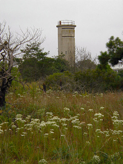
| Setting | Concrete Tower |
| Monumented | 1962 by NGS |
| Description (NGS) | NGS Datasheet |
Narrative and photographs
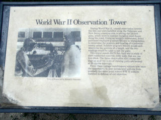
The tower (the northmost one of two in the immediate area) was found as described. The pair of towers is accessible from the parking area for a public beach. There is a fee to enter, unless you’re just taking photos of the towers (and you give the guy at the booth a nice smile). There are no changes to report except that Delaware Route 14 is now Delaware Route 1. See (link removed: reference is gone and no suitable replacement was found, 3/2011) for historical information on the towers that line the shore.

