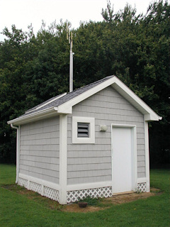
OC 13
Spatial/elevation data
| Coordinates | N 38.446666° W 75.05945° (estimate) |
| Elevation | 7.20 ft. |
| Location | Maryland
Worcester County Assawoman Bay Quad |
Mark description
| Type | Bench Mark Disk |
| Setting | Concrete Base |
| Monumented | 1977 by MDDOT |
| Description (NGS) | NGS Datasheet |
Narrative and photographs
It is likely that this little “house,” located 0.35 miles west along 141st Street from Coastal Highway, surrounds the pump and the mark. The door was locked and therefore I couldn’t gain access.


