1 USCG (HU0379)
1 USCG
Note Entered on August 31, 2003
Spatial/elevation data
| Coordinates | N 38.451251° W 75.054878° |
| Elevation | 10.52 ft. |
| Location | Delaware
Sussex County Assawoman Bay Quad |
Mark description
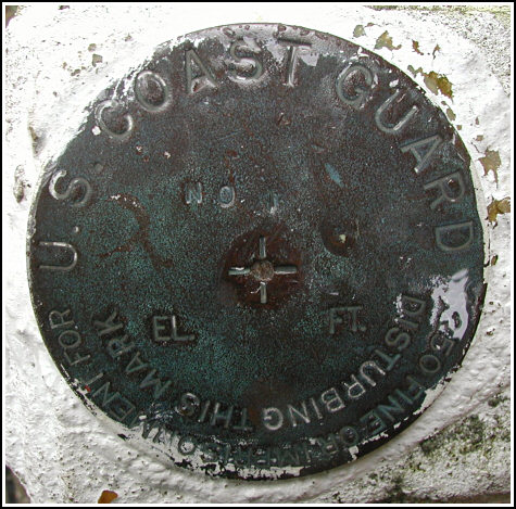
| Type | Survey Disk |
| Setting | Concrete Post |
| Monumented | by U. S. Coast Guard |
| Description (NGS) | NGS Datasheet |
Narrative and photographs
I haven’t yet determined how to log this mark. At the southeast corner of the fence around the lighthouse—now a white iron fence, not a woven steel fence as described—I found a Coast Guard disk stamped “No. 1” set in a concrete post. However, the post projects much more than the five inches mentioned in the description; it projects at least twice that, and possibly more (I did not measure it at the time). To confuse the situation further, there is a Coast Guard mark with a separate PID of HU1478 somewhere at the lighthouse site. This mark is stamped identically to HU0379, but is set in a post projecting two feet. From the description it cannot be determined which fence corner this mark stood adjacent to.

