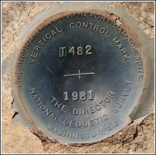
T 482 (GQ0194)
T 482
Spatial/elevation data
| Coordinates | N 36.0562° W 112.1208° |
| Elevation | 6976.75 ft. |
| Location | Arizona
Coconino County Phantom Ranch Quad |
Mark description
| Type | Bench Mark Disk |
| Setting | Rock Outcrop |
| Monumented | 1981 by NGS |
| Description (NGS) | NGS Datasheet |
NGS recovery information
Descriptive text
Mark recovered in good condition. The visitor center referred to in the description is no longer in use. The current visitor center (Canyon View Center) is located near Mather Point.Narrative and photographs
This morning was our last at the Canyon, and we soon headed along the East Rim drive and away from Grand Canyon Village. Our first stop wasn’t even going to be a stop. Many times benchmarks that look interesting at home are less than thrilling once we arrive at the spot; oftentimes they may well be interesting, but the other activities of the day may overshadow the desire for a benchmark hunt, or simply push it away. In this case, I was fully prepared to drive on by T 482, but Rich drove tantalizingly slow past the coordinates anyway, and I couldn’t resist a peek into the woods. Well, what do you know, there’s the witness sign! I hopped out and found the mark easily, along with a bonus mark (PP38) belonging to a local surveyor just a few yards away. Just a few yards from the road and an old service station, these marks are located in a pretty wood filled with pinyon pines, red rocky soil and with a small woods road running by the sandstone outcrop that holds the NGS disk. The disk is in excellent condition and is easily accessible.

