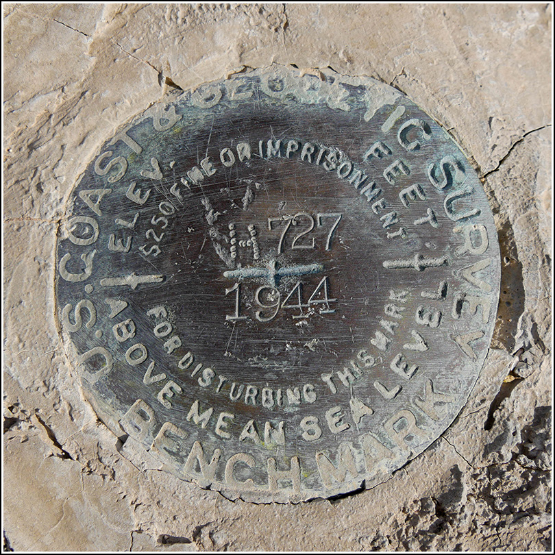
H 727 (DW0376)
H 727
Recovered in Good Condition on March 29, 2019
Spatial/elevation data
| Coordinates | N 33.690175° W 115.801879° |
| Elevation | 2080.55 ft. |
| Location | California
Riverside County Cottonwood Spring Quad |
Mark description
| Type | Bench Mark Disk |
| Setting | Rock Outcrop |
| Monumented | 1944 by NGS |
| Description (NGS) | NGS Datasheet |
NGS recovery information
Descriptive text
Recovered in good condition.Narrative and photographs
We had one disappointment earlier today while on our first exploration of Joshua Tree National Park, when we were unable to find G 727. But there was another benchmark on my list along Cottonwood Springs Road, and this one had adjusted coordinates so we were pretty sure it would be findable (or, if nothing else, we would know for certain if it was gone). The disk was in place and in good condition, and it was in another incredibly beautiful spot among the wildflowers!
Funny thing about this disk is that whoever set it may have forgotten their letter stamps, because the “H” in the designation was punched out using a series of dots rather than being stamped as usual.


