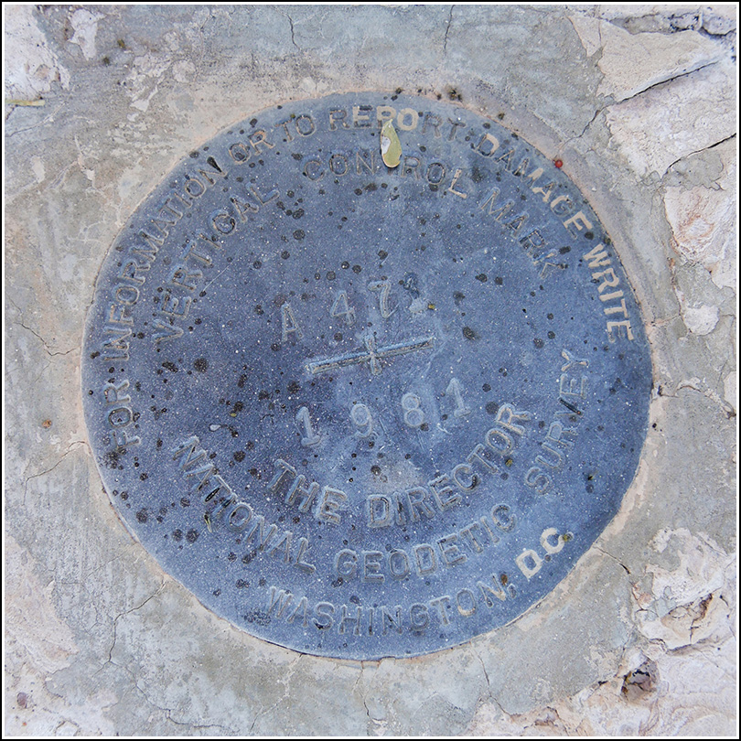
A 471 (DA1200)
A 471
Spatial/elevation data
| Coordinates | N 32.028777° W 112.799944° |
| Elevation | 1743.73 ft. |
| Location | Arizona
Pima County Tillotson Peak Quad |
Mark description
| Type | Vertical Control Mark |
| Setting | Rock Outcrop |
| Monumented | 1981 by NGS |
| Description (NGS) | NGS Datasheet |
NGS recovery information
Descriptive text
Recovered in good condition. The witness post and sign are still in place.Narrative and photographs
The next one was a bit tricky too, but we found a decently sized pulloff on the same (east) side of the road as the mark. The only problem was that we had to walk down the road shoulder for a short distance before we could hop up onto a level, relatively clear surface. (Keep in mind the traffic is moving at 70+mph—yikes. And there is a lot of traffic at this time of year, mainly RVs going to and from Rocky Point in Mexico.)
I was walking toward the coordinates when Rich said “here it is!” But it actually wasn’t A 471—what he had found was a Department of Agriculture disk only about 50 feet away from the disk we had been seeking, which turned out to be right alongside the road. So we got a two-fer this time, and as a bonus will get to correct the handheld coordinates submitted by a geocacher (he had obviously made a typo and was off by a full minute of longitude).
A 471 is in good condition, as described in 1981. The witness sign is still present.

