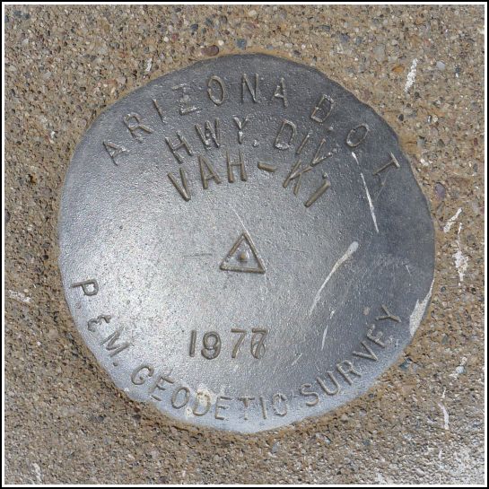
VAH KI (CZ1952)
VAH KI
Recovered in Good Condition on June 2, 2011
Spatial/elevation data
| Coordinates | N 32.978528° W 111.353077° |
| Elevation | 1679 ft. |
| Location | Arizona
Pinal County Cactus Forest Quad |
Mark description
| Type | Survey Mark |
| Setting | Round Concrete Monument |
| Monumented | 1977 by AZDOT |
| Description (NGS) | NGS Datasheet |
NGS recovery information
Descriptive text
The station and both reference marks were recovered in good condition. All marks are set in round concrete monuments. The witness post and sign are still in place. The highway is now Arizona State Route 79. Handheld GPS coordinates for RM 1 are 32 58 42.4 (N) 111 21 10.8(W). Handheld GPS coordinates for RM 2 are 32 58 43.0(N) 111 21 11.4(W).Narrative and photographs
VAH KI was our next find. This was extremely easy to spot and in fact Rich spotted it from the road. All three marks were in a line and just a few meters apart along a fence line. While we were taking our photos a man came zooming toward us on an ATV. Unlike what we might expect at home, though, he slowed down and waved pleasantly as he passed (also of note, he didn’t harass us about what we were doing, just left us alone).


| Designation | Status | Condition | Image |
|---|---|---|---|
| VAH KI RM 1 | Recovered | Good |
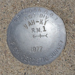
|
| VAH KI RM 2 | Recovered | Good |
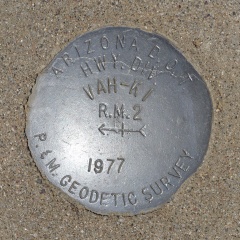
|