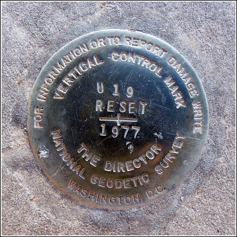
U 19 RESET
Recovered in Good Condition on March 24, 2019
Spatial/elevation data
| Coordinates | N 32.223386° W 110.973622° |
| Elevation | 2374.85 ft. |
| Location | Arizona
Pima County Tucson Quad |
Mark description
| Type | Vertical Control Mark |
| Setting | Concrete Base |
| Monumented | 1977 by NGS |
| Description (NGS) | NGS Datasheet |
NGS recovery information
Descriptive text
Recovered in good condition.Narrative and photographs
Tonight’s adventure, following a delicious pizza supper at Reilly, was an attempt to find two downtown Tucson benchmarks we had never looked for in the past. It was a short walk from the restaurant through the nearly deserted downtown toward the courthouse/city hall buildings. The first mark, U 19 RESET, was an easy find, set into the concrete base of a former light pole. The disk is in good condition with legible stamping.


