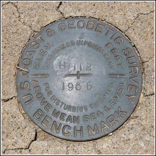
H 112 (CZ0717)
H 112
Spatial/elevation data
| Coordinates | N 32.287167° W 111.1804° |
| Elevation | 2806.1 ft. |
| Location | Arizona
Pima County Avra Quad |
Mark description
| Type | Bench Mark Disk |
| Setting | Square Concrete Monument |
| Monumented | 1935 by NGS |
| Description (NGS) | NGS Datasheet |
NGS recovery information
Descriptive text
Disk recovered in good condition. Monument has surface cracking as noted in the 2001 recovery. Handheld GPS coordinates are 32 17 13.8(N) 111 10 49.4(W).Narrative and photographs
This afternoon’s activities involved a search for several benchmarks near and along the Encinas Trail in Saguaro National Park. H 112 was the first one on our list, and it also just so happens to be a virtual geocache! While we’re not so enthused about searching for geocaches these days, we figured it would be a nice opportunity for a cache find in Arizona, along with several potential benchmark finds. It was a lengthy hike in the heat of the day, but we enjoyed walking along the trail (actually an old road) and eventually came upon the mark. It is in good condition and is set into a square concrete monument surrounded by a beautiful variety of cacti. As with many of these desert marks, the monument has some surface cracks but they don’t appear that they will endanger the mark anytime soon.


