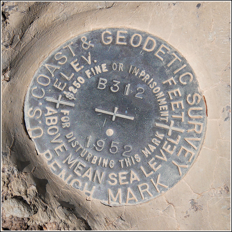
B 312
Recovered in Good Condition on March 28, 2019
Spatial/elevation data
| Coordinates | N 31.960527° W 112.789694° |
| Elevation | 1679.36 ft. |
| Location | Arizona
Pima County Lukeville Quad |
Mark description
| Type | Bench Mark Disk |
| Setting | Rock Outcrop |
| Monumented | 1952 by NGS |
| Description (NGS) | NGS Datasheet |
NGS recovery information
Descriptive text
Recovered in good condition. The witness post and sign are still in place. The white painted letters “BM” are no longer evident.Narrative and photographs
After our fruitless benchmark search near the visitors center, we headed onto the Ajo Mountain Drive to look for two more benchmarks along the way to the southern end of the old county road. (Which was not really the southern end of the road, but it is the southern end of the part that’s now used as a trail.) The first, B 312, was a very easy find on a prominent rock outcrop. I was hoping the white painted letters “BM” from the 1953 description would still be evident, but I wasn’t too surprised that they weren’t. The witness post and sign are still in place. The mark is in excellent condition.

