BM #6
BM #6
Spatial/elevation data
| Coordinates | N 44.3387° W 73.895217° |
| Elevation | 482.156 ft. |
| Location | New York
Essex County Lake Placid Quad |
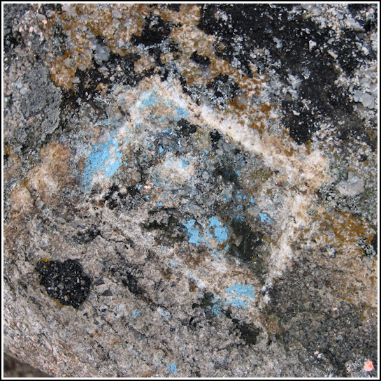
Mark description
| Type | Chiseled Square |
| Setting | Boulder |
| Monumented | Unknown by Unknown Agency |
Narrative and photographs
This was an unexpected find, and we still haven’t found any further information about this mark. We were on our way back to Lake Placid after a disappointing trip to Whiteface (we’d hoped to watch the sunset from the summit, but the road had closed hours earlier). We were intrigued by the Wilmington Flume, and spent quite a long time poking around and taking photographs of the rushing water. A small overlook nearby seemed like it might offer better views of the rapids, so we split up and explored the area. I found nothing exciting, but Rich came across this chiseled square! It’s just a few yards west of Route 86 near Whiteface. The stake and flagging tape look relatively new, but the mark could easily be older. The chiseled square is quite distinct, but we still might not have noticed it without the stake.

