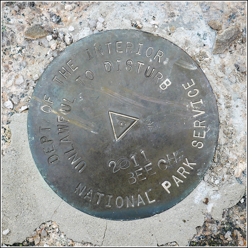
BEECH
BEECH
Recovered in Good Condition on September 12, 2019
Spatial/elevation data
| Coordinates | N 44.311145° W 68.345226° |
| Elevation | 833.08 ft. |
| Location | Maine
Hancock County Southwest Harbor Quad |
Mark description
| Type | Triangulation Station Disk |
| Setting | Bedrock |
| Monumented | 2011 by National Park Service |
| Description (National Park Service) | The mark is a 3 1/2 inch brass disk with a 2 1/4 inch flanged stem set in a drill hole in bedrock with hydraulic cement. To access, follow Beech Hill Rd south to trail head for Beech Mountain summit. Hike up the trial until the fire tower is in view (0.5 miles). The mark is set in bedrock just a few feet (25?) SE of the trail. The mark is part of the NPS-URI network of backbone monuments for Acadia National Park. See: Shared Solution for BEECH |
Narrative and photographs
For a few years now we’ve been wanting to take Dad to the fire tower at the summit of Beech Mountain, but so far it hadn’t worked out. This year it figured nicely into our plans, and as a bonus, we would be able to recover the one remaining URI survey mark, BEECH, that we had yet to find. The hike to the summit is short and steep and mostly wooded, with a few short stretches across open ledges. We passed through beech, hemlock and laurel. Before long we were on the summit ledge, and before reaching the fire tower we stopped to look for the mark. It was set in 2011 and was in excellent condition if you can ignore the goofy stamping.

