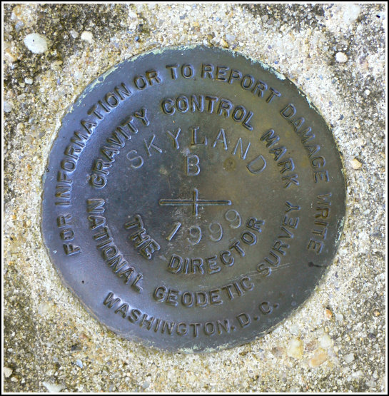
SKYLAND B
Recovered in Good Condition on October 2, 2006
Spatial/elevation data
| Coordinates | N 38.593° W 78.375633° |
| Elevation | 3696 ft. |
| Location | Virginia
Madison County Big Meadows Quad |
Mark description
| Type | Gravity Station Disk |
| Setting | Round Concrete Monument |
| Monumented | 1999 by NGS |
| Description (NGS) | NGS Datasheet |
NGS recovery information
Descriptive text
Recovered in good condition.Narrative and photographs
Rich and I found this mark as described, in the parking lot for the Stony Man trailhead. We were in this very same spot yesterday when we hiked the Stony Man Trail, but (believe it or not) I was feeling “benchmarked-out” and was more in the mood for dinner than for documenting yet another mark. So we headed to Skyland for a delicious, relaxing meal, and came back today to photograph this mark. We found the disk to be in good condition, and no changes to the datasheet description are necessary.


