U 397
Spatial/elevation data
| Coordinates | N 24.546516° W 81.797467° |
| Elevation | 3.17 ft. |
| Location | Florida
Monroe County Key West Quad |
Mark description
| Type | Bench Mark Disk |
| Setting | Concrete Base |
| Monumented | 1988 by Florida Dept. of Natural Resources |
| Description (NGS) | NGS Datasheet |
Narrative and photographs
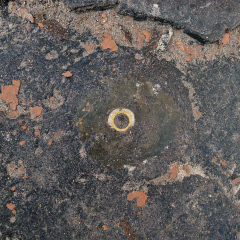
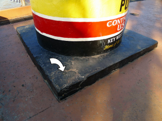
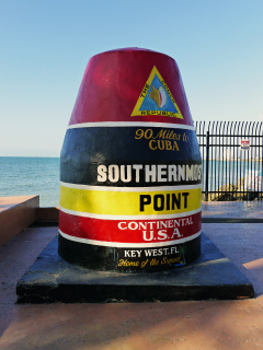
Our first goal for today was to check out the Southernmost Point monument, hopefully before the majority of tourists arrived. A few groups beat us there, but before long we were able to have our photo taken at the monument and, more importantly, were able to poke around to search for what remains of the benchmark there (after waiting patiently for a break in the action, and taking some photos for other groups). Unfortunately the disk is gone (it was last seen in 2008), but the stem is still in place and the impression left by the disk is still apparent in the concrete. It’s always sad to see this. The benchmark has been marked Destroyed in the NGS database, and it’s very unlikely that it will be replaced.


