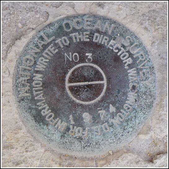
872 4557 TIDAL 3
Recovered in Good Condition on February 23, 2014
Spatial/elevation data
| Coordinates | N 24.547733° W 81.784783° |
| Elevation | 2.66 ft. |
| Location | Florida
Monroe County Key West Quad |
Mark description
| Type | Tidal Bench Mark Disk |
| Setting | Concrete Sidewalk |
| Monumented | 1974 by National Ocean Service |
| Description (NGS) | NGS Datasheet |
NGS recovery information
Descriptive text
Recovered in good condition.Narrative and photographs
We had a series of four benchmarks to search for at the White Street Pier. The first, 872 4557 TIDAL 3, was very easy to find; I knew exactly where to look because I had “cheated” and spotted it beforehand on Google Street View. It’s set into the top of the curb at the northeast corner of the pier. The disk is in good condition.
