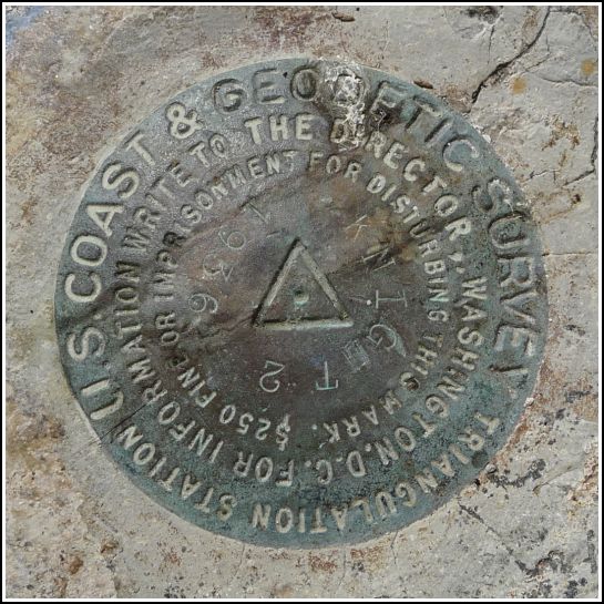
KNIGHT 2 (AA0299)
KNIGHT 2
Spatial/elevation data
| Coordinates | N 24.707031° W 81.124749° |
| Elevation | 26.55 ft. |
| Location | Florida
Monroe County Marathon Quad |
Mark description
| Type | Triangulation Station Disk |
| Setting | Bridge Wingwall |
| Monumented | 1936 by NGS |
| Description (NGS) | NGS Datasheet |
NGS recovery information
Descriptive text
The station mark was recovered in good condition. It is set into the south wingwall of the east abutment of Old Seven Mile Bridge. The mark is approximately 1.5 feet south of the edge of the bridge. Reference mark 1 was not searched for. Reference mark KNIGHT RM 2 was recovered in good condition on the same wingwall as the station, and approximately 10 feet southeast of the station.Narrative and photographs
After spending the morning on Pigeon Key, which we accessed by boat tour from the visitors center, we walked back to our car along the Old Seven Mile Bridge. At the eastern end of the bridge we noticed a signup stand for Friends of Old Seven, a group that raises funds for the preservation and continued maintenance of the bridge. We talked with the man at the stand for a while and mentioned our interest in survey markers, wondering if he had seen the ones we were looking for (KNIGHT 2 and its one remaining reference mark, and an unrelated benchmark Y 69 RESET). He pointed out the survey markers on the eastern abutment. I always appreciate it when people have taken notice of their surroundings and are aware of benchmarks before we tell them! We recovered all three marks—one of which, KNIGHT 2, was in a rather precarious spot—without any problems. The reference mark for KNIGHT 2 is only about 10 feet away from the station itself.


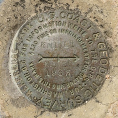
| Designation | Status | Condition | Image |
|---|---|---|---|
| KNIGHT RM 2 | Recovered | Good |
|