75 C
75 C
Spatial/elevation data
| Coordinates | N 41.01827° W 75.60998° |
| Elevation | 1625.299 ft. |
| Location | Pennsylvania
Carbon County Blakeslee Quad |
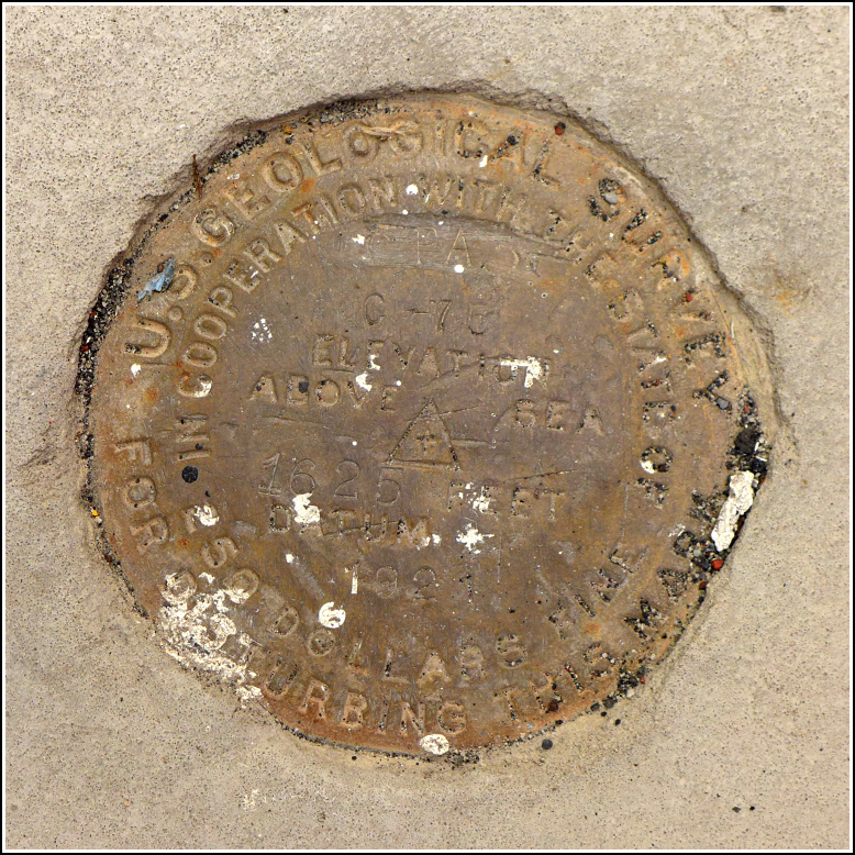
Mark description
| Type | Bench Mark Disk |
| Setting | Concrete Foundation |
| Monumented | 1921 by USGS |
| Description (USGS) | Albrightsville, 0.2 mi E. of; on N. side of rd.; in NW. corner of concrete platform at front entrance of schoolhouse; standard tablet stamped “75 C 1921PA” |
Narrative and photographs
Every year Rich and I, along with my father, attend the Banff Mountain Film Festival world tour showing at Northampton Community College. And before the show, which is always in the evening, we choose a place to hike (and, of course, a place for dinner). This year we picked a new place to hike—Hickory Run State Park. Rich and I haven’t been there in years, and Dad has never been there. We showed dad the boulder field and then hiked the Hawk Falls Trail and part of the Orchard Trail.
I also always try to include at least one benchmark hunt in the day’s activities. There aren’t many NGS marks nearby (we found the tri-station HICKORY over a decade ago), so I searched the topo map and identified a few USGS marks that looked like solid possibilities. We ended up finding only one, 75 C at the old Albrightsville schoolhouse.
I was surprised to see the schoolhouse still standing and in very good shape! In 2015, two women from the area decided to reopen the school building and manage it as a community center. It is now officially the “Schoolhouse Central Enrichment Hub.” (Schoolhouse gets new lease on life)
The disk is in good condition, with mostly legible stamping. Note that it is actually stamped C 75 and not 75 C. At the time of our recovery, the disk was concealed by a small wooden planter that is easily moved off to the side to access the mark.


