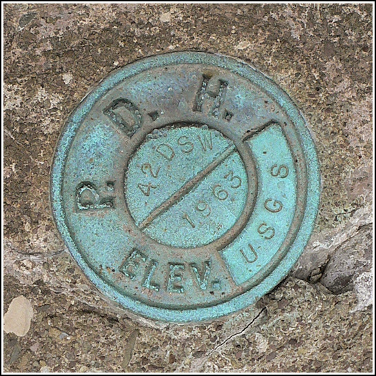
42 DSW
42 DSW
Recovered in Good Condition on September 26, 2009
Spatial/elevation data
| Coordinates | N 41.412767° W 75.495233° |
| Elevation | 1651.309 ft. |
| Location | Pennsylvania
Lackawanna County Lake Ariel Quad |
Mark description
| Type | Bench Mark Disk |
| Setting | Bridge Wingwall |
| Monumented | 1963 by USGS |
| Description (USGS) | Mt. Cobb; about 300 ft SE. of, along rd. leading to Wimmers; in SE. end of N. wingwall of concrete bridge over large drain; PDH standard disk stamped “42 DSW 1963 USGS” |
Narrative and photographs
This was an easy find on our way to buy pie, cider, and donuts at a nearby cider mill. This is a USGS mark that, interestingly, uses a standard PDH disk. The mark is in good condition.

. Disk is on the near wingwall, just below the PDH keystone plaque.")