41 M
41 M
Spatial/elevation data
| Coordinates | N 41.60942° W 75.50835° |
| Elevation | 1738.124 ft. |
| Location | Pennsylvania
Lackawanna County Carbondale Quad |
Mark description
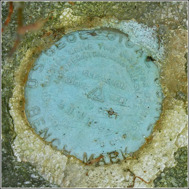
| Type | Bench Mark Disk |
| Setting | Boulder |
| Monumented | 1942 by USGS |
| Description (USGS) | Carbondale, 3.0 mi NW. of; 175 ft SE. of top of steep grade and rd. NE.;, to mine; 80 ft SE. of 18-in. double beech tree; 45 ft NE. of and on opposite side of hwy. from 14-in. maple tree; 20 ft NE. of hwy.; in boulder; standard tablet stamped “41 M 1942” Reference mark; 140 ft NW. of tablet; 35 ft SE. of rd. NE.; 20 ft SW. of hwy.; in edge of bank; on boulder; chiseled square (1745.04 ft) |
Narrative and photographs
Our final find for today, that was coincidentally (…or not) on our way to the Waymart Hotel, was 41 M. Even though it was a side-of-the-road mark, which are typically not that exciting, this was a fun and challenging hunt.
By this point in the summer the roadsides are typically overgrown with weeds, and that’s what I found along Dundaff Street near the coordinates for 41 M. I walked up and down the road but couldn’t find a single boulder among the weeds or in the woods behind. Finally a breeze blew a small tree’s branches aside and the sun hit at just the right angle, and I spotted the mottled gray surface of a boulder! I hopped over the ditch and lifted the tree branch to discover the disk set into the high point of the boulder.
I wasn’t so lucky with the reference mark, which was supposed to be a chiseled square on a boulder on the other side of the road. There were a few boulders but they had obviously been placed there more recently than 1942, and they weren’t in the correct location.

