40 B
Spatial/elevation data
| Coordinates | N 41.44681° W 75.95724° |
| Elevation | 1081.70 ft. |
| Location | Pennsylvania
Wyoming County Center Moreland Quad |
Mark description
| Type | Bench Mark Disk |
| Setting | Concrete Step |
| Monumented | 1942 by USGS |
| Description (USGS) | Vernon, in village of; 65 ft N. and 48 ft E. from junction of rd. NE.; in SW. corner of concrete doorstep to Union Church; standard tablet stamped “40 B 1942 1082” |
Narrative and photographs
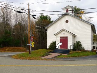
Benchmarks set into buildings like post offices or churches are usually easy targets; that is, they are usually easy to find and, failing that, easy enough to determine that they are gone. So I put the benchmark on the Vernon Baptist Church on our list for today. Google Street View shows what appears to be carpeting covering the steps of the church. That doesn’t necessarily mean that the mark is inaccessible: see 47 B for an example of carpeted church steps with the benchmark still in plain view.
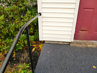
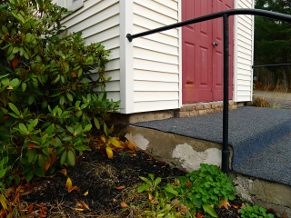
We weren’t so lucky today. As we approached the steps I could see that they were fully covered, with no opening cut for the disk. We did see a telltale “hump” in the southwest corner that looked exactly like what you would expect to see if a benchmark disk were covered over with carpeting, but we wanted to get a better look. Rich was able to peek underneath to confirm that the “hump” was indeed a disk, but we couldn’t get far enough underneath to read the designation or get a photo. It’s too bad that the intersection was so busy right at that moment; otherwise we might have peeked a little more deeply. Because we weren’t able to read the designation and so cannot strictly say that this is 40 B, we’ll just submit a note for now.
Additionally, it appears that this is no longer the Vernon Baptist Church. The sign is gone and there was no activity at the site. Their website now shows the church’s location south of Center Moreland, along Demunds Road.


