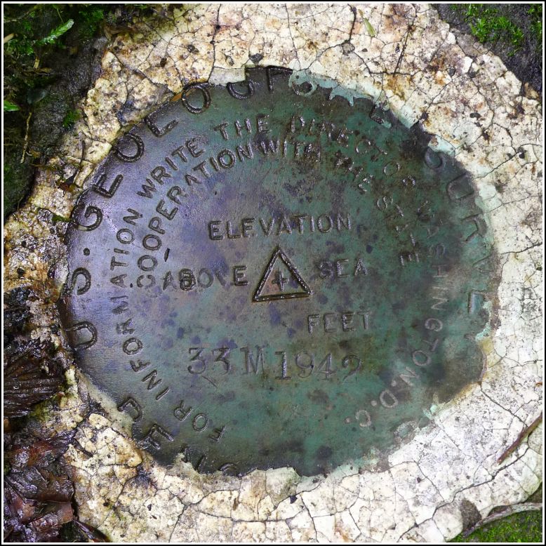
33 M
33 M
Spatial/elevation data
| Coordinates | N 41.70139° W 75.36924° |
| Elevation | 1333.810 ft. |
| Location | Pennsylvania
Wayne County Aldenville Quad |
Mark description
| Type | Bench Mark Disk |
| Setting | Boulder |
| Monumented | 1942 by USGS |
| Description (USGS) | Whites Valley; 150 ft SE. of Stonewall Inn; 70 ft SW. of State Highway 670; 40 ft SE. of dirt rd. S.; 20 ft SE. of stone wall; in rocky pasture; in boulder; standard tablet stamped “33 M 1942” |
Narrative and photographs
33 M had the potential to be an easy find, until we arrived at the site and found that what had been a rocky pasture in 1942 is now dense, brushy forest.
We had two good reasons for not trampling through the brush. Wayne County is the poison ivy capital of Pennsylvania, as far as I can tell. And Pennsylvania is pretty much the Lyme-disease-carrying deer tick capital of the country. And then: “I just saw a snake!” Dad exclaimed, “I’m not going in there.” Make that three reasons. (Although I really like snakes … he does not.)
But probably against better judgment, I couldn’t stand being so close to the coordinates and not at least trying. We found a large boulder near the road that at first looked like a good candidate. Most of the top surface was clear of moss and we could tell that there was no disk set in this nice, big, easy-to-access boulder. About ten yards further into the woods I spotted another boulder, flat and nearly level with the ground. I stood on top of the large boulder and thought I could make out a curved shape surrounded by a stripe of white—what appeared to be a disk set in cement. I fought my way to it and indeed, it was 33 M!
The bench mark is in very good condition and there is little chance it will disturbed in the near future. We didn’t see solid evidence of the stone wall, but the Stonewall Inn is still standing. It’s a private residence now, but the owners have a sign “Stone Wall Inn” over their front door. The dirt road referred to in the description is Johnson Creek Road (and it’s still dirt).


