26 JPN
Recovered in Poor Condition on July 14, 2007
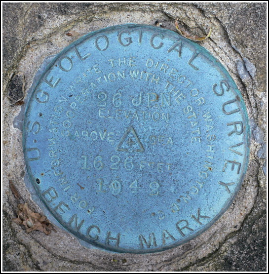
Spatial/elevation data
| Coordinates | N 41.346317° W 75.58833° |
| Elevation | 1626.572 ft. |
| Location | Pennsylvania
Lackawanna County Moscow Quad |
Mark description
| Type | Bench Mark Disk |
| Setting | Masonry Bridge Headwall |
| Monumented | 1942 by USGS |
| Description (USGS) | Scranton; 5.2 mi SE. of overhead crossing of E. & W.V. RR. over State Highway 307; 150 ft NW. of junction of hwy. and rd. S.; 36 ft SE. of hwy.; directly opposite two-story farmhouse; in SW. headwall of small masonry bridge over creek; standard tablet stamped “26 JPN 1942 1926” |
Narrative and photographs
This mark was easy to find, but unfortunately it is in very poor condition. It’s set into a cut stone that was once part of an old masonry culvert over a small creek. But the stone has been moved out of place and is now leaning at an angle, half on the ground and partially touching the stone beneath. The disk itself is in fine condition, but with its setting so disturbed it is useless. We had to wonder how this damage occurred.


