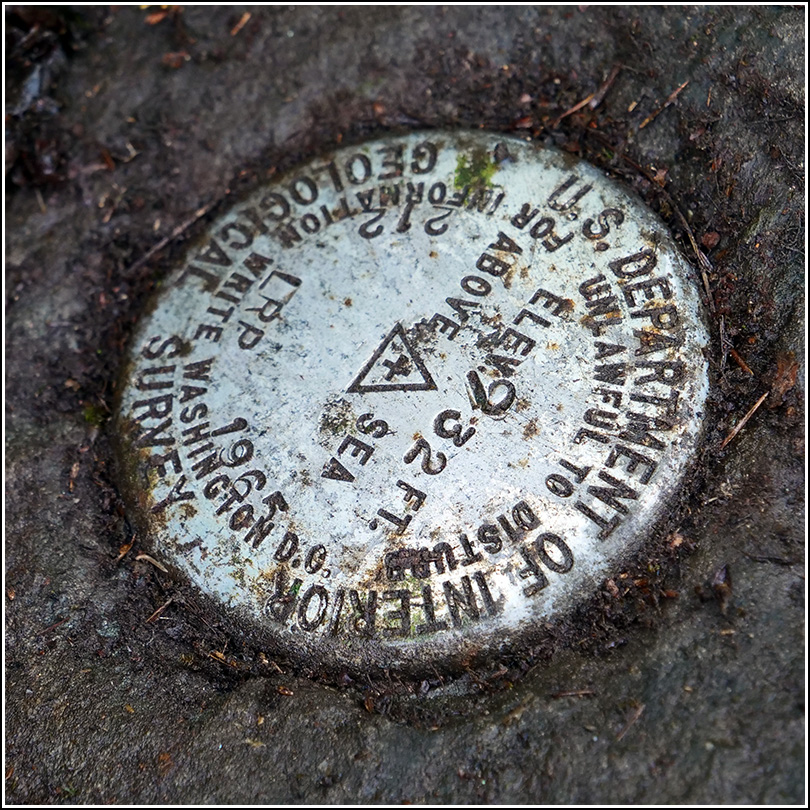
212 LRP
212 LRP
Spatial/elevation data
| Coordinates | N 41.55598° W 75.07812° |
| Elevation | 932 ft. |
| Location | Pennsylvania
Pike County Damascus Quad |
Mark description
| Type | Bench Mark Disk |
| Setting | Boulder |
| Monumented | 1965 by USGS |
| Description (USGS) | Mast Hope, 3.0 mi W. of; 300 ft N. of centerline of rd. at junction of drive N. to house of Mr. Badenhausen; 20 ft N. and 16 ft W. of, and 1.3 ft lower than center of bridge at stream crossing; in top of large boulder; standard tablet stamped “212 LRP 1965 932” |
Narrative and photographs
When we solved the puzzle and found the final location for CaptainMath’s Countdown Cache, I was excited to see a benchmark nearby on the topo map. It wasn’t until later that evening that Rich realized it was one we had already found! We were in the location for another geocache in 2005 and we had located it then. I had even submitted an official USGS recovery.
After finding today’s cache, we searched around for the benchmark. It took a few minutes because we were unsure exactly which rock it had been set on, and because everything was heavily overgrown. The bridge has also been replaced in the intervening years, and we thought the bridge construction might even have threatened the mark. Eventually I pushed aside a small tree and scraped the accumulated soil from the right spot, and noticed the mark. The disk is still in good condition, just as we left it 15 years ago.

