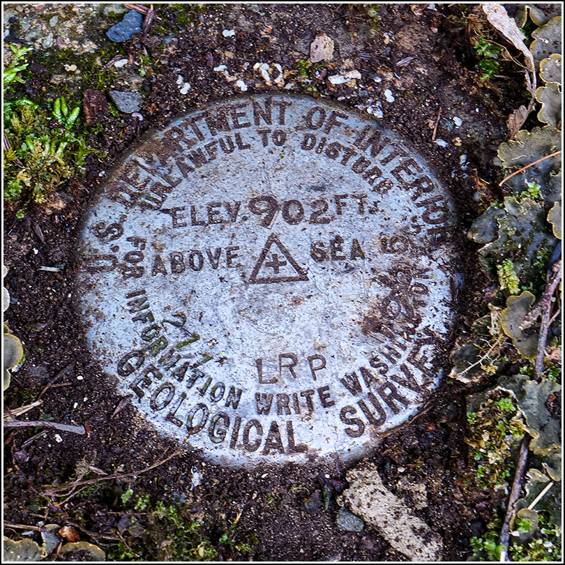
211 LRP
Recovered in Good Condition on July 10, 2020
Spatial/elevation data
| Coordinates | N 41.54923° W 75.05206° |
| Elevation | 902.116 ft. |
| Location | Pennsylvania
Pike County Narrowsburg Quad |
Mark description
| Type | Bench Mark Disk |
| Setting | Concrete Culvert |
| Monumented | 1965 by USGS |
| Description (USGS) | Mast Hope, 2.0 mi W. of; 18 ft S. of, and 1.0 ft lower than centerline of rd. at drain crossing; in center of top of S. headwall of concrete box culvert; standard tablet stamped “211 LRP 1965 902” |
Narrative and photographs
After our geocaching adventure and benchmark (re)recovery at the nearby State Game Lands, we drove a little further down Masthope Plank Road to look for two more benchmarks. Both were supposed to be set on old concrete culverts, and I never get my hopes up about those—usually, I’ve found, the culverts have been replaced and the disks are gone. But in this case, we were lucky! The old concrete culvert headwall was still in place. It was covered with a layer of moss that was apparently housing a large ant colony. Beneath it, I found the disk! The benchmark is in good condition. This part of the culvert headwall appears to be in good shape, too, although the rest of the culvert wall has shifted and may not be stable.

