13-06 12 A
13-06 12 A
Recovered in Good Condition on August 25, 2007
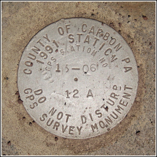
Spatial/elevation data
| Coordinates | N 40.96672° W 75.75502° |
| Elevation | Unknown |
| Location | Pennsylvania
Carbon County Weatherly Quad |
Mark description
| Type | GPS Survey Monument |
| Setting | Bridge Abutment |
| Monumented | 1991 by County of Carbon |
| Description (County of Carbon) | Unavailable. |
Narrative and photographs
Rich and I returned today to the scene of last week’s deluge. This time, though, we drove to the southern terminus of the trail (at Glen Onoko, which is also the starting point for the annual Death Hike) and planned to ride north to Penn Haven Junction, where we had turned around last time, or perhaps even further to Rockport. We made it to Rockport, as you can tell by the fact that we found this survey monument at the bridge over Buck Mountain Creek at Rockport. It’s dated 1991 and it’s right in the middle of the trail, so I’m not sure how we didn’t notice it before. It’s a Carbon County GPS station (we’ve found at least one of these before) and is in good condition.

