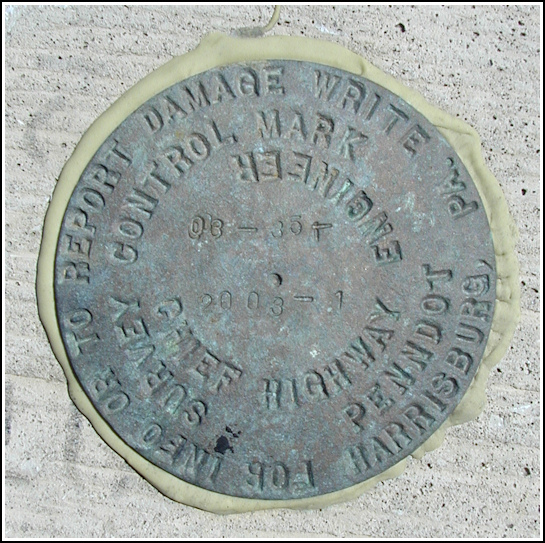
03-35T
03-35T
Recovered in Good Condition on July 23, 2005
Spatial/elevation data
| Coordinates | N 41.43532° W 75.4856° |
| Elevation | Unknown |
| Location | Pennsylvania
Lackawanna County Lake Ariel Quad |
Mark description
| Type | Survey Control Mark |
| Setting | Concrete bridge headwall |
| Monumented | 2003 by PennDOT |
| Description (PennDOT) | Unavailable. |
Narrative and photographs
Rich, Aaron and I first spotted this mark while on our unintentional Fourth of July death walk around Cortez. Much too hot, sweaty and exhausted to consider examining it in any detail that day, we gave it little more than a glance. Rich and I returned a few weeks later (just after giving up on the Country Birds Sing geocache due to poison ivy) to document the mark. It’s one of the most recently set marks I’ve found, and it’s in excellent condition. The mark is set into the east headwall of a new concrete bridge over Wallenpaupack Creek (West Branch) along Cortez Rd.


