BILLINGS RM 2
Recovered in Good Condition on September 10, 2014
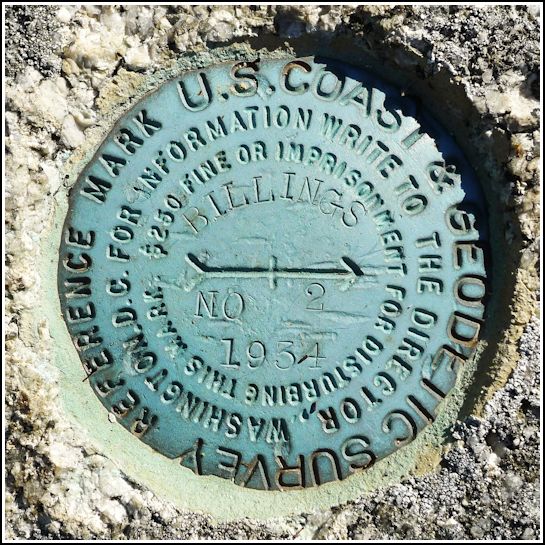
Spatial/elevation data
| Coordinates | N 44.31515° W 68.66955° |
| Elevation | Unknown |
| Location | Maine
Hancock County Sargentville Quad |
Mark description
| Type | Reference Mark Disk |
| Setting | Rock Outcrop |
| Monumented | 1934 by NGS |
Narrative and photographs
For more information about this reference mark, see its parent mark BILLINGS RESET.


