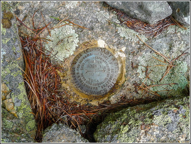
BROWN MOUNTAIN RM 2
Note Entered on September 14, 2013
Previous recovery (June
18, 2006)
Spatial/elevation data
| Coordinates | N 44.324333° W 68.296583° |
| Elevation | Unknown |
| Location | Maine
Hancock County Southwest Harbor Quad |
Mark description
| Type | Reference Mark Disk |
| Setting | Bedrock |
| Monumented | 1934 by NGS |
Narrative and photographs
For more information about this reference mark, see its parent mark BROWN MOUNTAIN.
