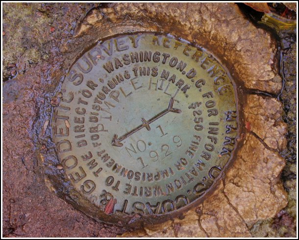
PIMPLE HILL RM 1
Recovered in Good Condition on October 31, 2002
Spatial/elevation data
| Coordinates | N 41.026783° W 75.5045° |
| Elevation | Unknown |
| Location |
|
Mark description
| Type | Reference Mark Disk |
| Setting | Rock Outcrop |
| Monumented | 1929 by NGS |
Narrative and photographs
For more information about this reference mark, see its parent mark PIMPLE HILL RESET.


